Granard

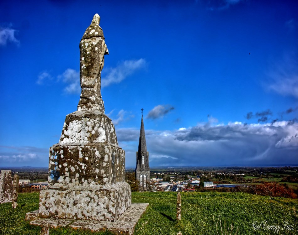
Statue of St Patrick on top of the Motte - photo by Noel Carrigy
Granard is the second largest town in County Longford and lies on the N55 route from the Midlands Region to the Northern Counties. Granard is surrounded by beautiful lakes such as Lough Gowna and forests like Derrycassin Woods.
The name Granard has many meanings - The Hill of the Sun, The Hill of the Grain or Ugly Height. All of these could be attributed to the most memorable feature in Granard - the great Norman earthwork, the largest in Ireland, which rises up at the west end of the main street. This became the site for a castle built in 1199 by Richard Tuite who had been granted the lands by Hugh de Lacy.
Granard has had a varied and colourful history as is witnessed by the many time it has been mentioned in various annals and is well worth a visit.
History of Granard
The very earliest form of the name was Granairud. Later we find it mentioned as Granaret. A twelfth century scribe wrote it Granairud, but added, by way of explanation, that the place is called Granard nowadays. A ninth century life of St. Patrick calls it Granard. So the present-day form of the name has, at least, one thousand years behind it. The slight twist of the name from its ancient forms, and especially the introduction of ard, gave much scope for speculation to place-name enthusiasts. Some of these think that Granard means height of the sun, and that in pagan times it was a station for sun worship. Others say that the name means a high and sunny spot. Dr. O’Donovan rejects the idea that the name is derived from grian -the sun, and says that the name simply means Corn height or perhaps Barley hill. We sometimes hear it stated that Granard means the ugly height. Nobody of importance supports this theory. Dr. O’Donovan mentions it only to reject it. Probably Granairud and Granaret are both pre-Celtic names to which our Gaelic ancestors gave a Gaelic semblance; much as Gaelic names were later given corrupt English forms. Irish scholars have tried to explain the meaning and origin of the name. All we can say for certain is that Granard is one of the oldest place names in Ireland.
Granard Motte & Bailey

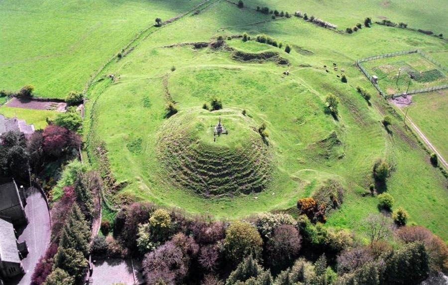
The most memorable feature of Granard is the great Norman earthwork, the largest in Ireland, which rises up at the end of the main street, the site of a castle erected here in 1199 by Richard Tuite, who was granted the lands of Granard by Hugh de Lacy.
The Motte is a great flat-topped earthen mound, on top of which would have been a timber tower surrounded by a palisade. Across the base was a U-shaped bailey, an enclosure surrounded by a palisade ditch. Animals and soldiers were housed in the bailey. It is very strongly fortified except on the southern side, which seems to have been guarded solely by the deep trench on the summit, out of which defenders fired arms and hurled stone missiles at the approaching enemy. Richard de Tuite occupied it in 1199 as part of an initiative to extend Norman control over the country.
Standing 534 ft above sea level it is reputed to be the highest Motte in Ireland. The summit affords a view of five lakes, parts of nine counties and faint outline of the Sliabh Bloom Mountains. Many myths are attached to the Motte, some say there is a castle concealed within it, others say it contains vast treasures of gold, while others maintain the hollow in the centre was a grain store.
Town History
Held by the de Gennevilles and de Mortimers during the C13, Granard was reclaimed in the C15 by the O'Fearghaills and soon became a significant Irish market centre. In 1419 Parliament enacted a statute forbidding English merchants from trading there because of the damage it had caused to the markets of Meath. By the late C16 the town had reverted to the Crown, and in 1618 it was granted with the surrounding lands to Sir Francis Aungier. Neither castle nor any medieval building survives, and Granard today is a regular Georgian street town which was laid out during the late c 18 and early c 19. In 1787, when the Rev. Daniel Beaufort visited the place, it was a small town with a few neat looking houses and a footbarrack, whose proprietors, the McCartneys, had just recently erected a neat markethouse. Building continued during the ensuing decades, and two wall plaques record the building of Moxhams Street in 1809 and Water Street, erected by Tomas Tuite in 1813. The houses are of the characteristic large-gabled type, two and three storeys high, with sash windows diminishing towards the eaves, fanlit doorcases and the occasional blocked door surround. By the mid C19 the town had begun to decline and, with the notable exception of St Mary’s Church, the townscape has changed little since then.
St. Mary's Church
St Mary’s Church is built on a predominant height overlooking the town. It was designed by John Burke, Dublin, at the request of Canon McGaver and the foundation stone was laid on 8th September 1860. The style is neo-gothic and the plan is cruciform. The church was formally opened for worship on 5th May 1867.
A good building that is made better by its splendid setting at the top of the towns main street, with the great Norman motte behind it. A prime instance both of skilful Victorian stage management and of the great confidence of the Irish Catholic Church in the mid C19. The effect is deceptive, accentuating the height of the church and thus exaggerating its overall size. St Marys, though tall, is in fact quite a small building, a short four-bay nave with two-bay transepts and a short chancel. The tower which flanks the south transept is four storeys high, with tapering corner buttresses, a double-louvred belfry and a broach spire with lucarnes. Built of sneaked limestone rubble with punched and ashlar trim. The detail is largely E.E. and exceptionally fine. A group of graded lancets and niches fills the entrance gable, framed by thin stone colonnettes. Cusped lancets in threes and pairs light the aisles and transept, and the east window consists of five cusped lights with geometric tracery. Nice clerestory with paired cusped lancets set in deep embrasures, framed by twin pointed arches on stone colonnettes, giving the effect of the classic E.E. galleried clerestory. The roof, a dominant feature of the interior, is an elaborate structure of hammer-beams and cross-braces, with decorative carved openwork.
Twenty years later the tower and spire, which rises to 170 ft, were added and the medieval style cross on top of the spire has become a local landmark.
Other Things to Do & See in Granard
Knights & Conquests Heritage Centre

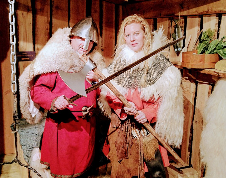
The Knights & Conquests Heritage Centre opened in late September 2018. Granard Motte Community Enterprise (GMCE) Clg, a local group of volunteers brought a dream to life and launched this tourist attraction. Experience a time of Knights & Conquests in Ireland’s Hidden Heartlands. Don the clothes of our Norman ancestors and walk on an interactive journey through time. See what it feels like to be a king or queen in your own game of thrones. Have a fun and unique experience with your family and friends. For bookings and to learn more go to www.knightsandconquests.ie.
Market House
Built in 1785. Oddly located on a gently sloping site at a right angle to the main street, indicating perhaps that the single-street town plan is a product of the late Georgian period. The classic Georgian market building, two storeys with a low hipped roof, arcaded throughout the ground floor, with regular sash windows on the upper storey. Rendered, with corner quoins and C19 drip-mouldings to the arches and windows. Built by the McCartneys; by the mid C19 it was the property of the Greville family. Described in 1889 as a disgraceful old building; it was refurbished C1980 and now functions as a branch library.
St. Patricks Church
This site, close to the Motte, was originally the site of Catholic worship in Granard. The present building is thought to have been built in the early part of the 18th century. Various alterations including a belfry (before 1836) and restoration work have been made, the most recent being in 1980. A Glebe House was built close to the Church in 1825 at a cost of f 1015-7-8, it was a large two-storied house with basement. This was inhabited by the various Vicars of the Church until 1940 and demolished in 1959.


